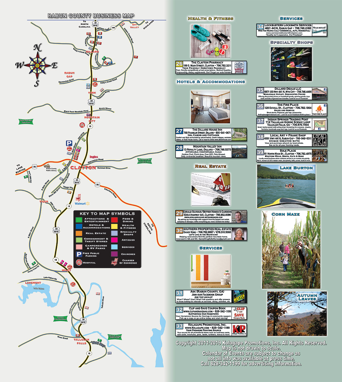
Directions to Rabun County – On the Eastern Continental Divide
From Atlanta: Rabun County, Georgia is just 90 miles from Atlanta. Take I-85 North from Atlanta to I-985 (which turns into Highway 441 at Cornelia) north to Clayton, the county seat.
From Asheville, NC: Clayton Georgia is 90 miles from Asheville. Take I-40 East to Waynesville and take highway 23 South into Georgia. Rabun County is the first county as you enter Georgia.
From Greenville/Spartanburg, SC: Rabun County is 45 miles from A. Take I-85 South. At Anderson, SC, take Highway 76 West. Cross the Chattooga River to enter Rabun County, Georgia
From Athens, GA: Rabun County is 80.7 miles from Greenville. Take 441 North. Follow 441/23 into Rabun County.
DOWNLOAD a printable copy of the Greater Rabun County Map


